Maps
Cartography and GIS
Using geographic information systems (GIS) for spatial data analysis and other supplementary tools I produce reference, artistic and thematic maps that provide meaningful information for navigation, data insights and tell unique stories. Here is a sample of some of the maps I've created.
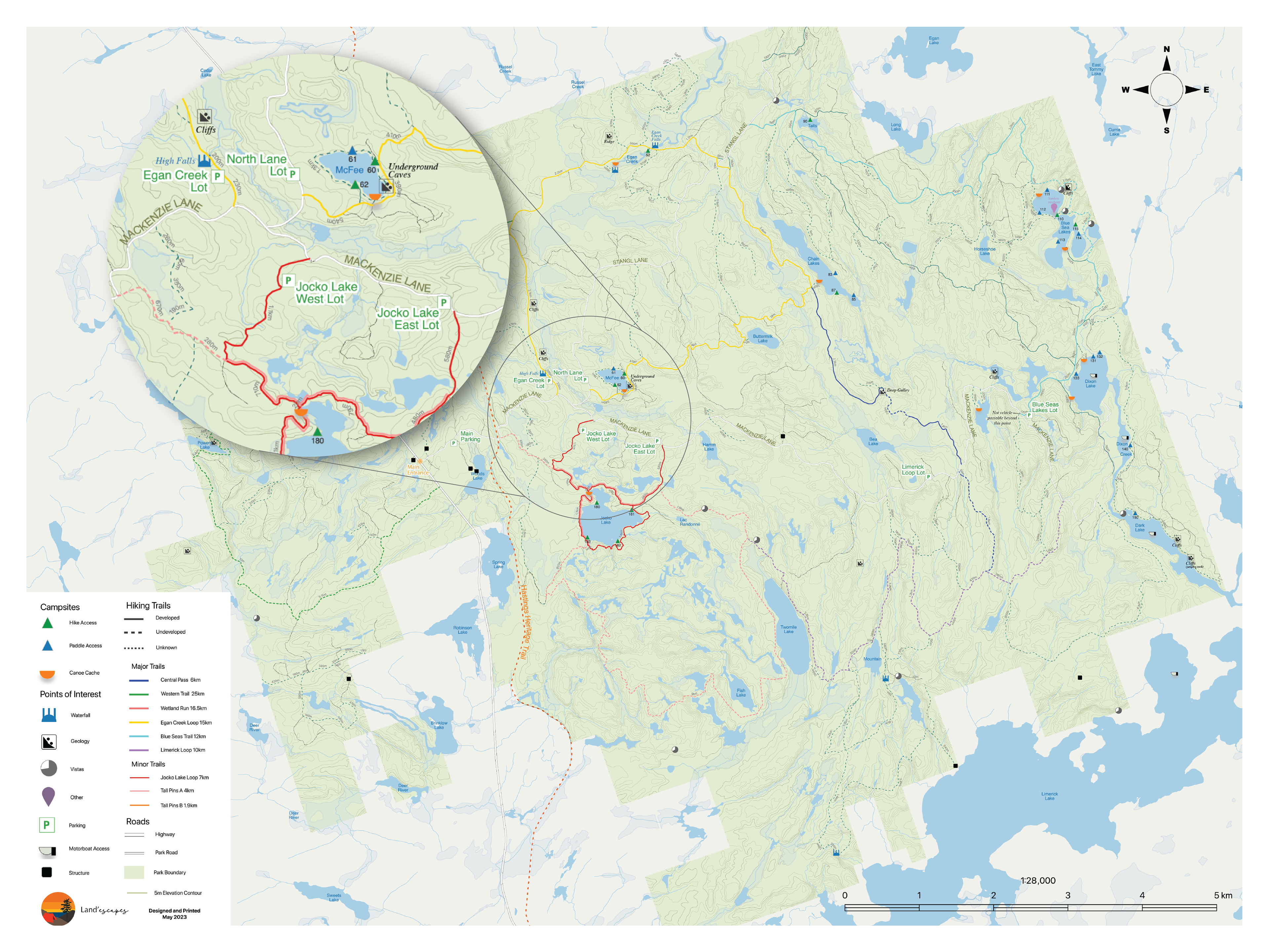
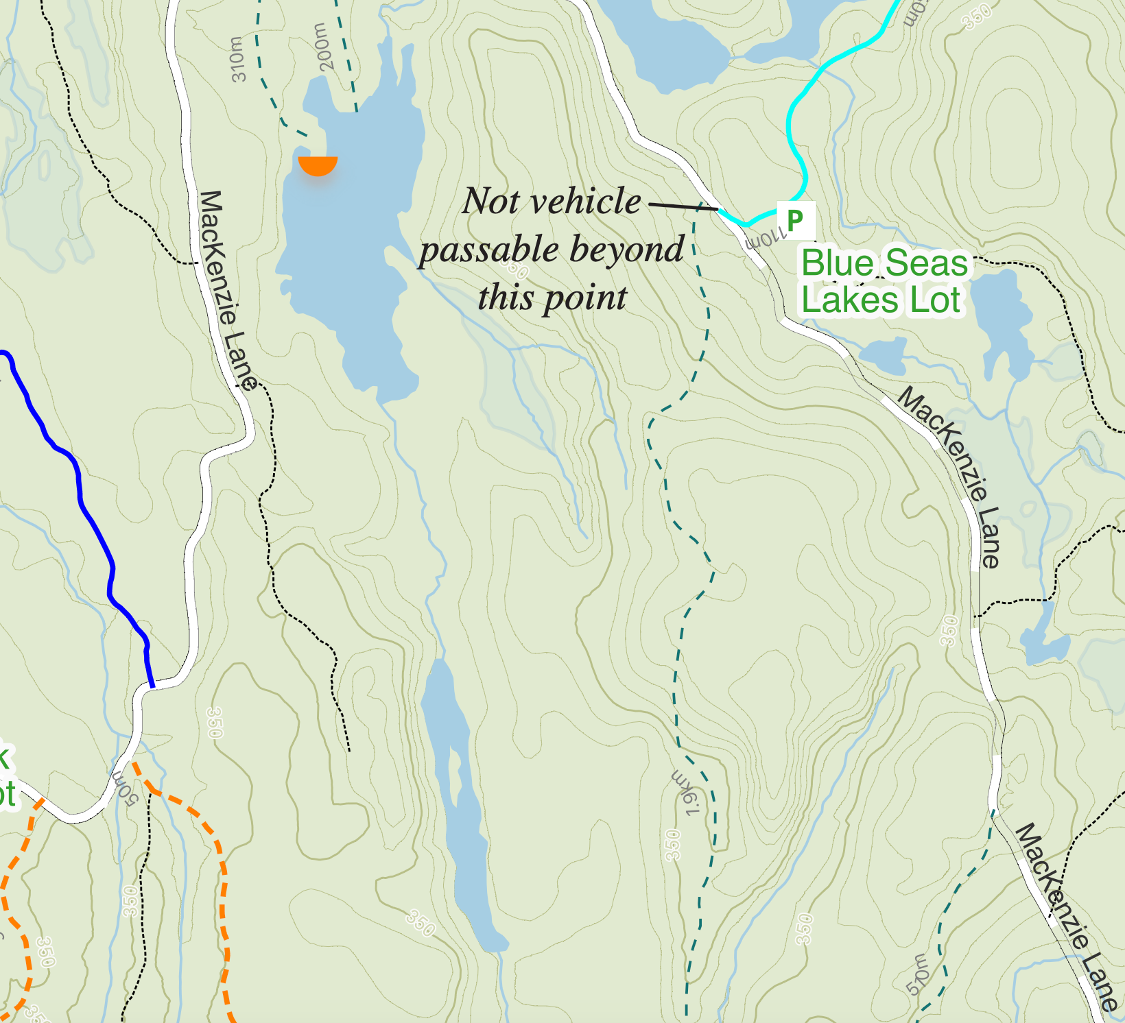
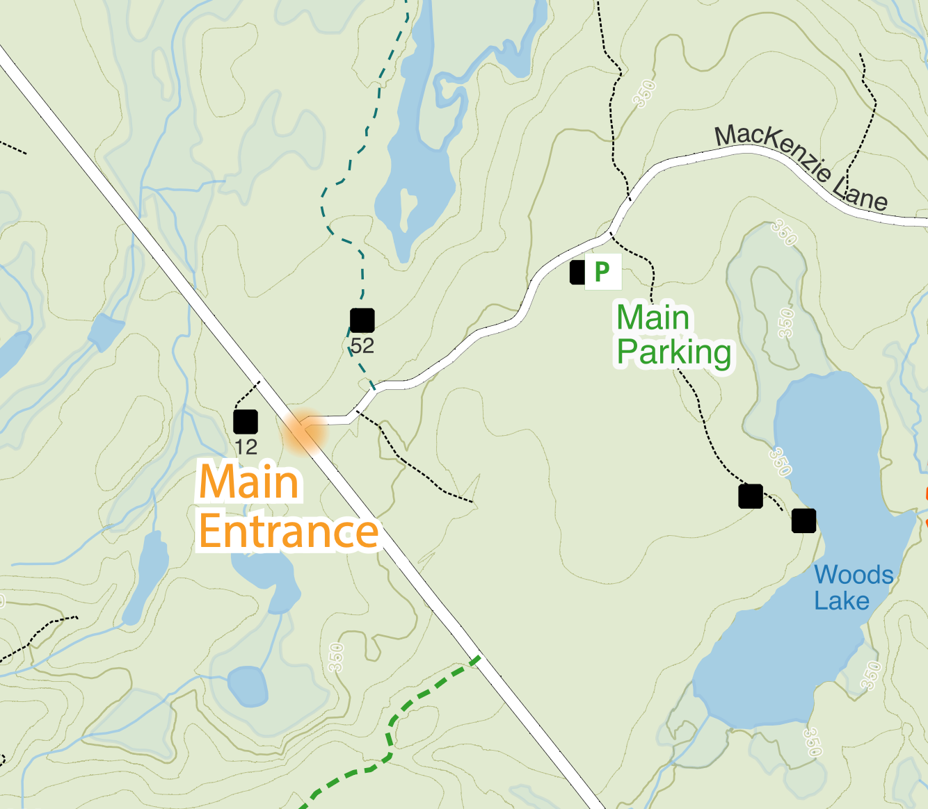
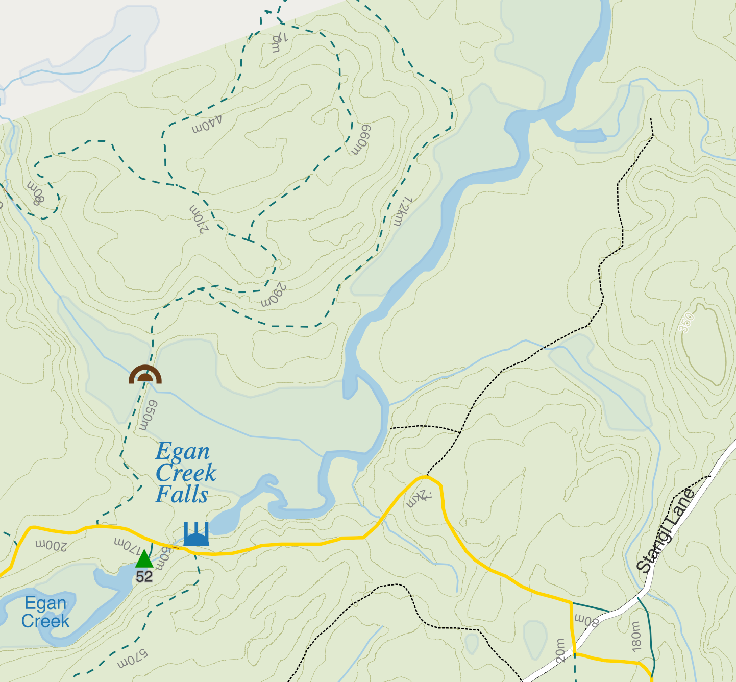
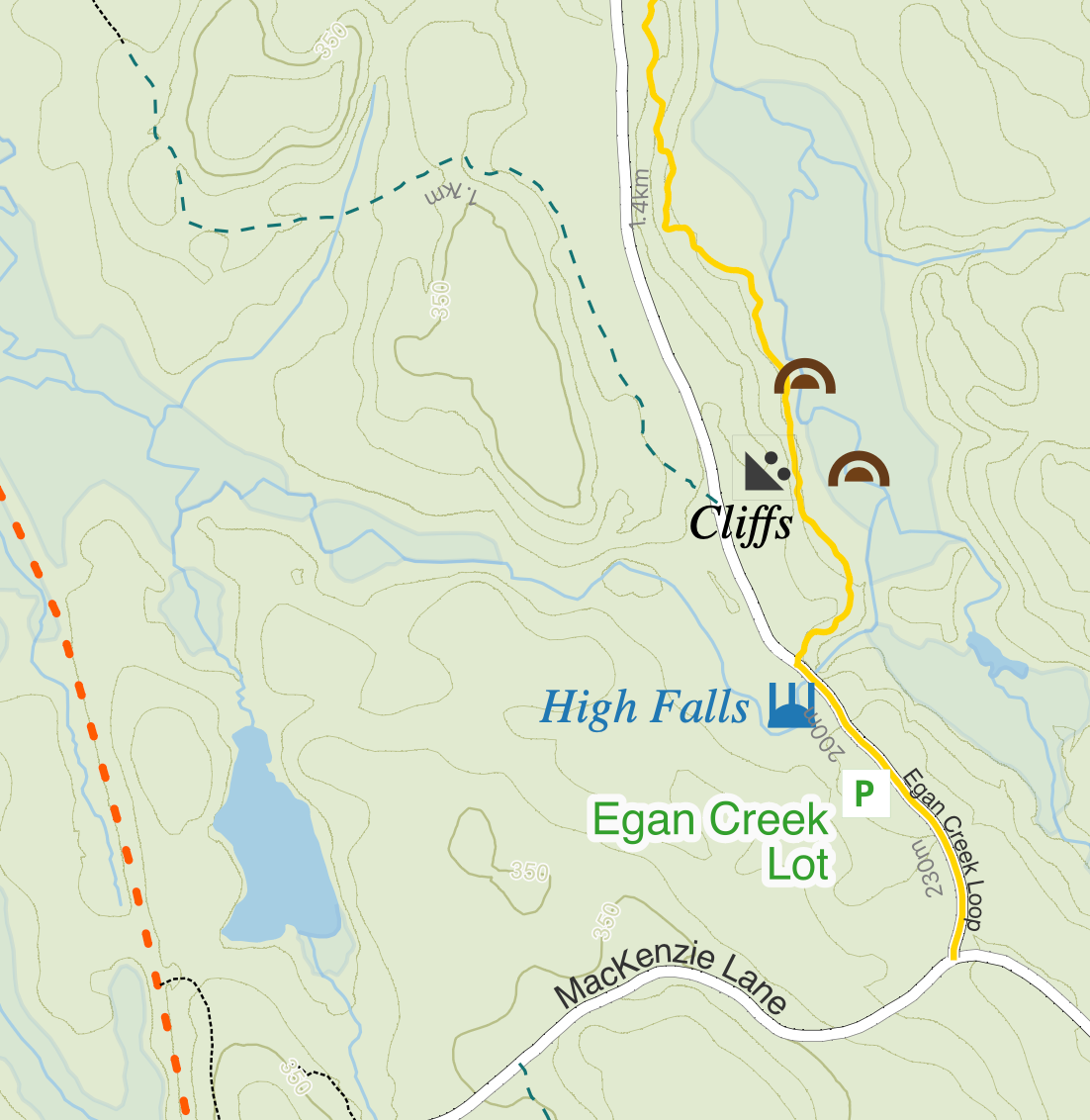
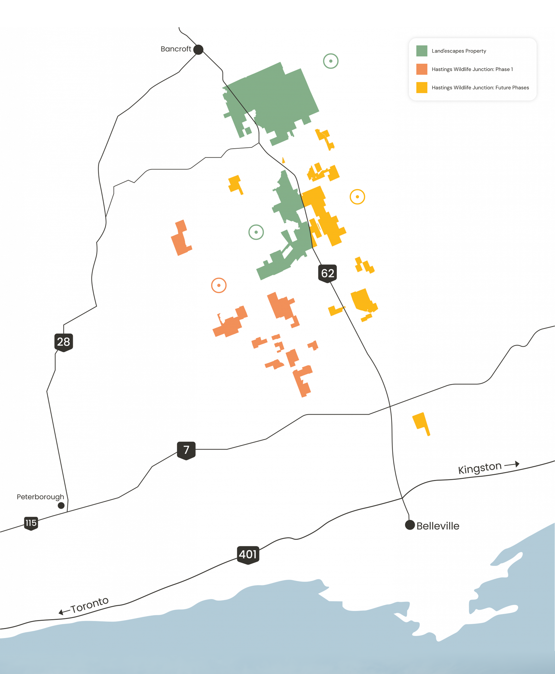
Park Map
Developed a highly detailed navigational map for a 26,000 acre park. The map features elevation data, over 200km of hiking trails and logging roads and hundreds of point features including campsites, boat caches, points of interest, access points, parking lots and more. This map was designed to be printed as well as used on a mobile phone as a georeferenced PDF.
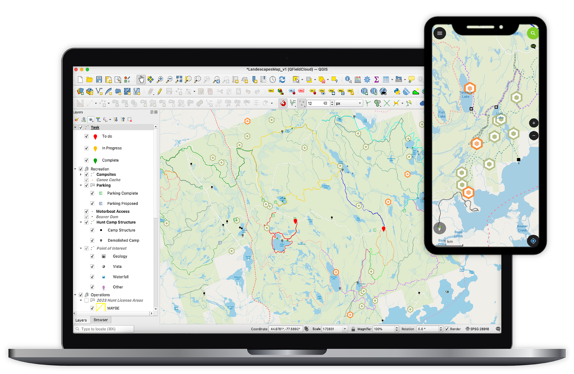
Field Data Collection App
Created a cloud-based data collection app using qfield cloud and QGIS to allow multiple team members to collect field data simultaneously. Often many areas where field data collection occurred lacked reliable network connections, necessitating the setup of every layer and feature to ensure seamless offline visibility.
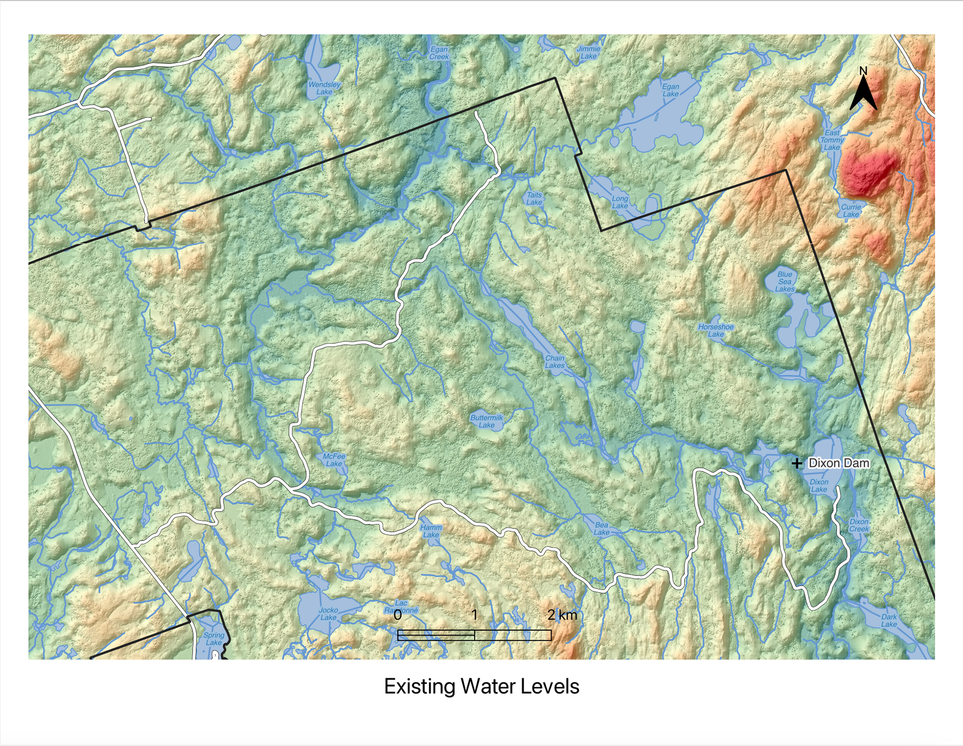
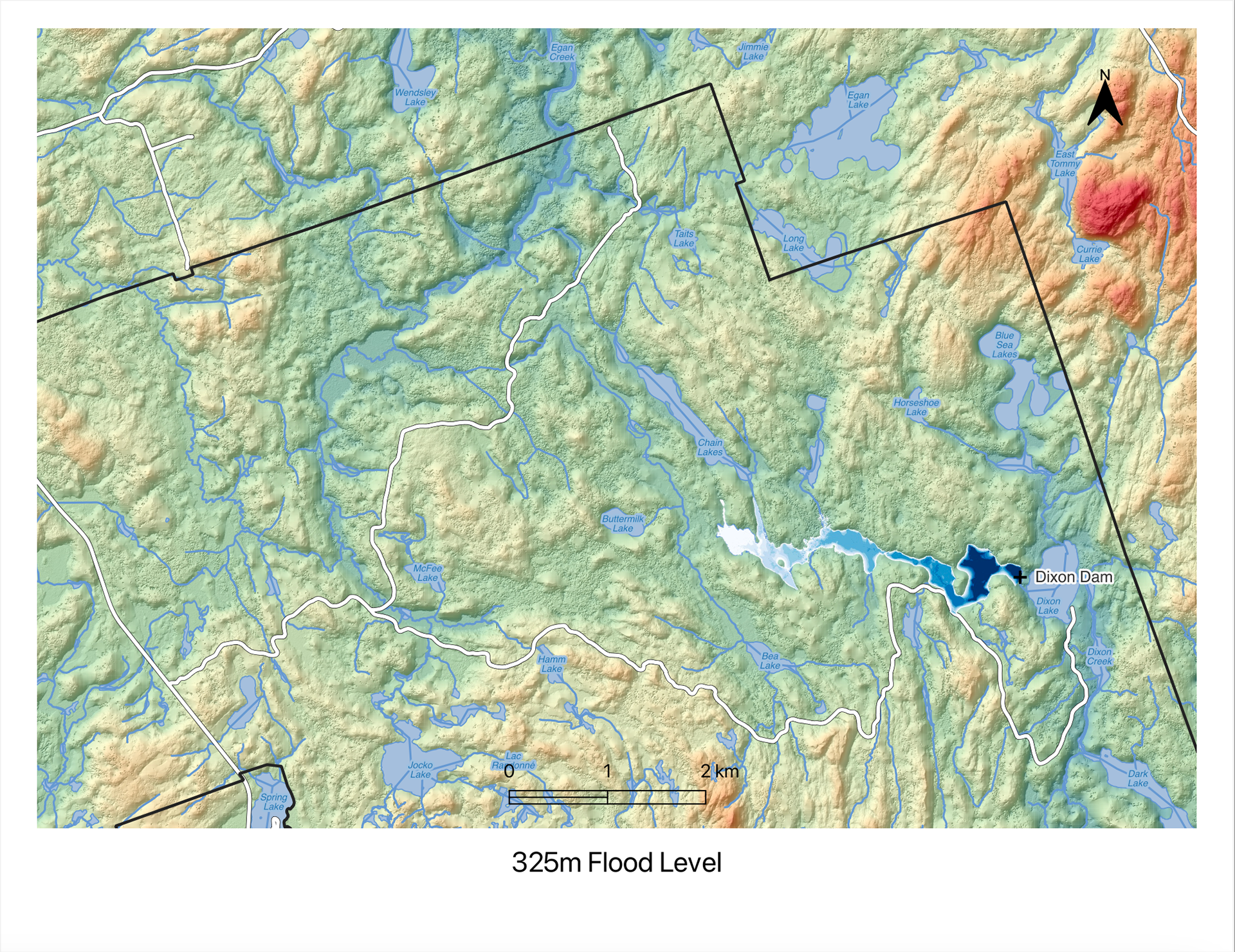
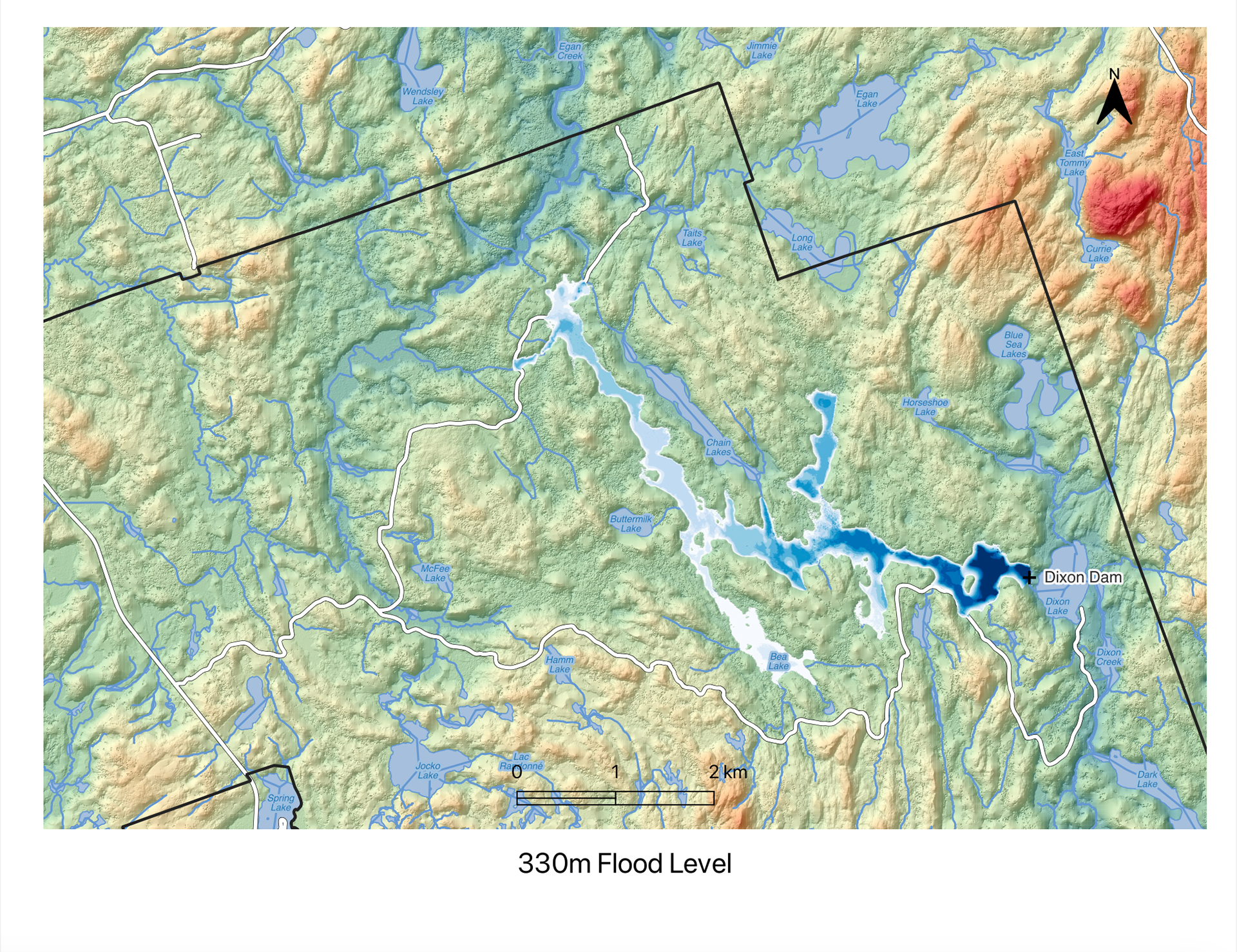
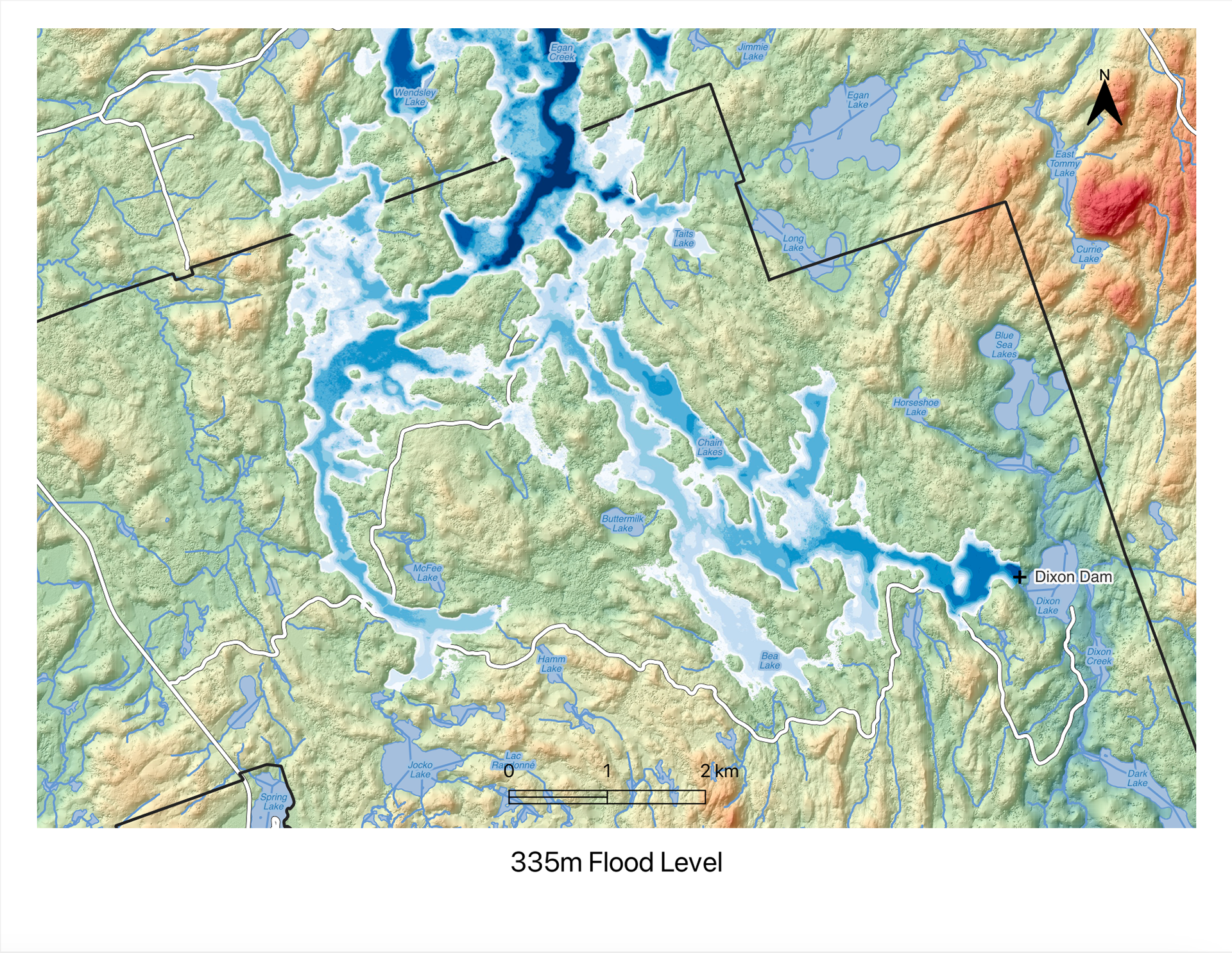
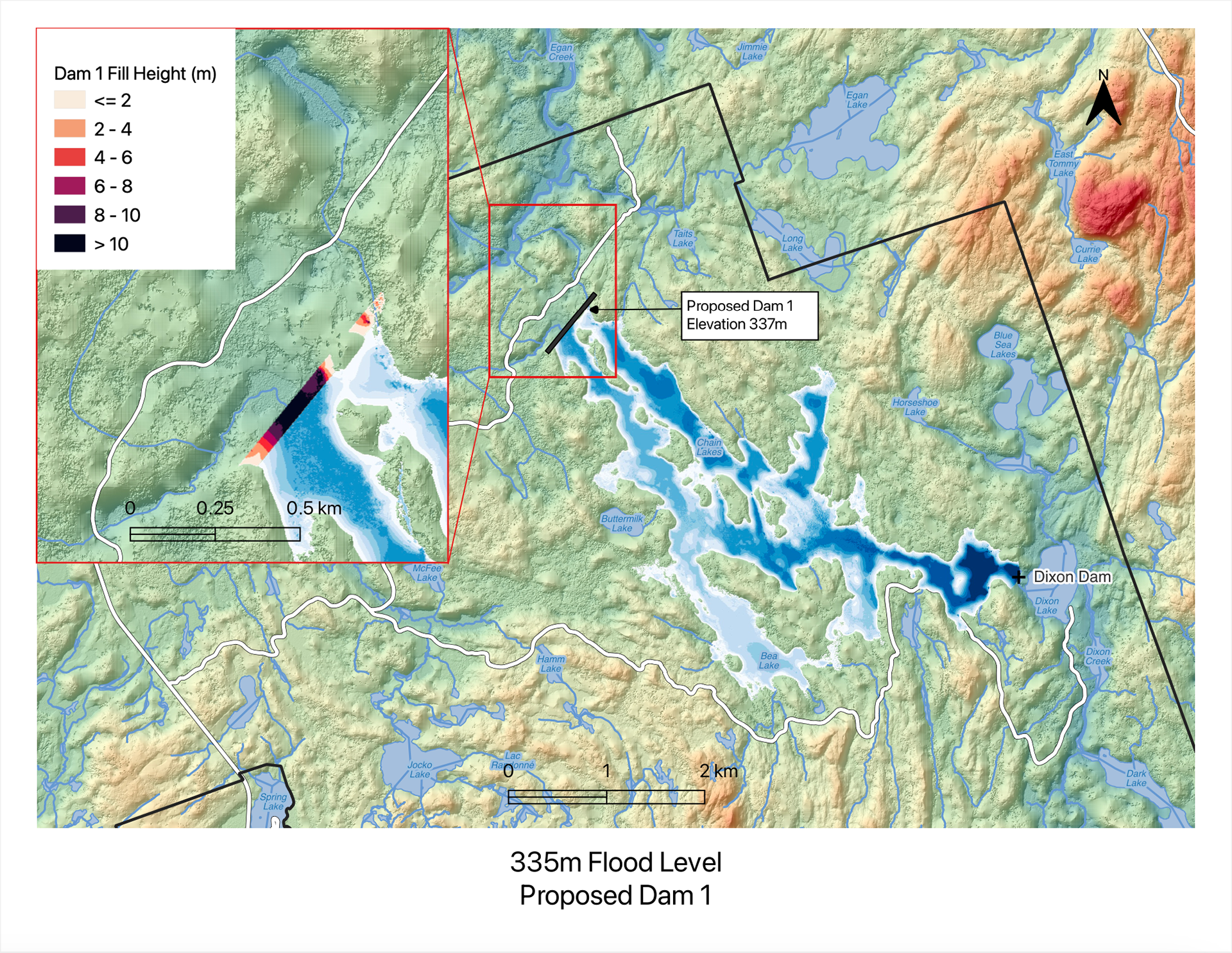
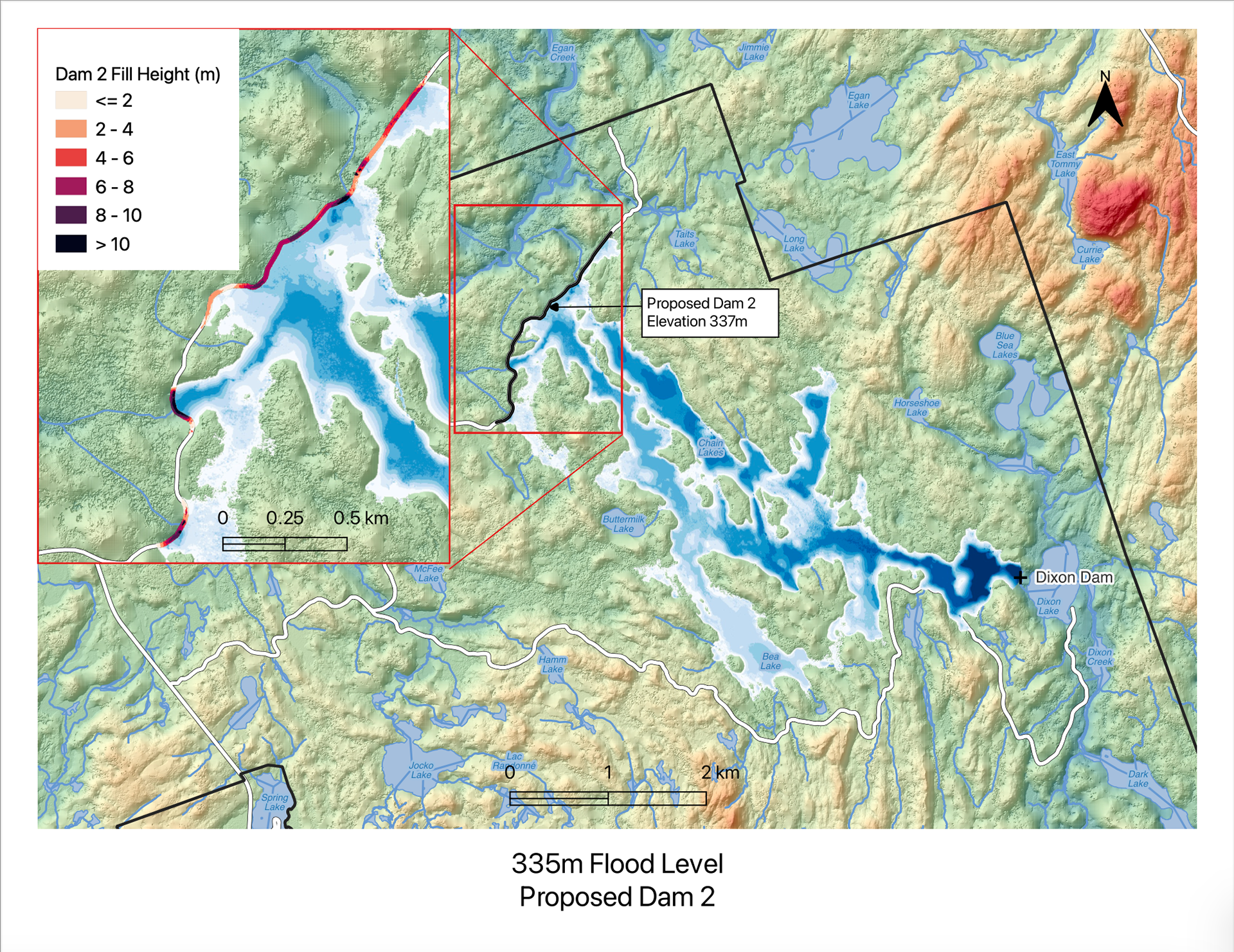
Dam Simulation
Conducted lake flooding simulations to forecast potential flood zones for dam installations at varying heights of 325m, 330m, and 335m. In response, alternative dam proposals aimed at mitigating flooding impacts were formulated.

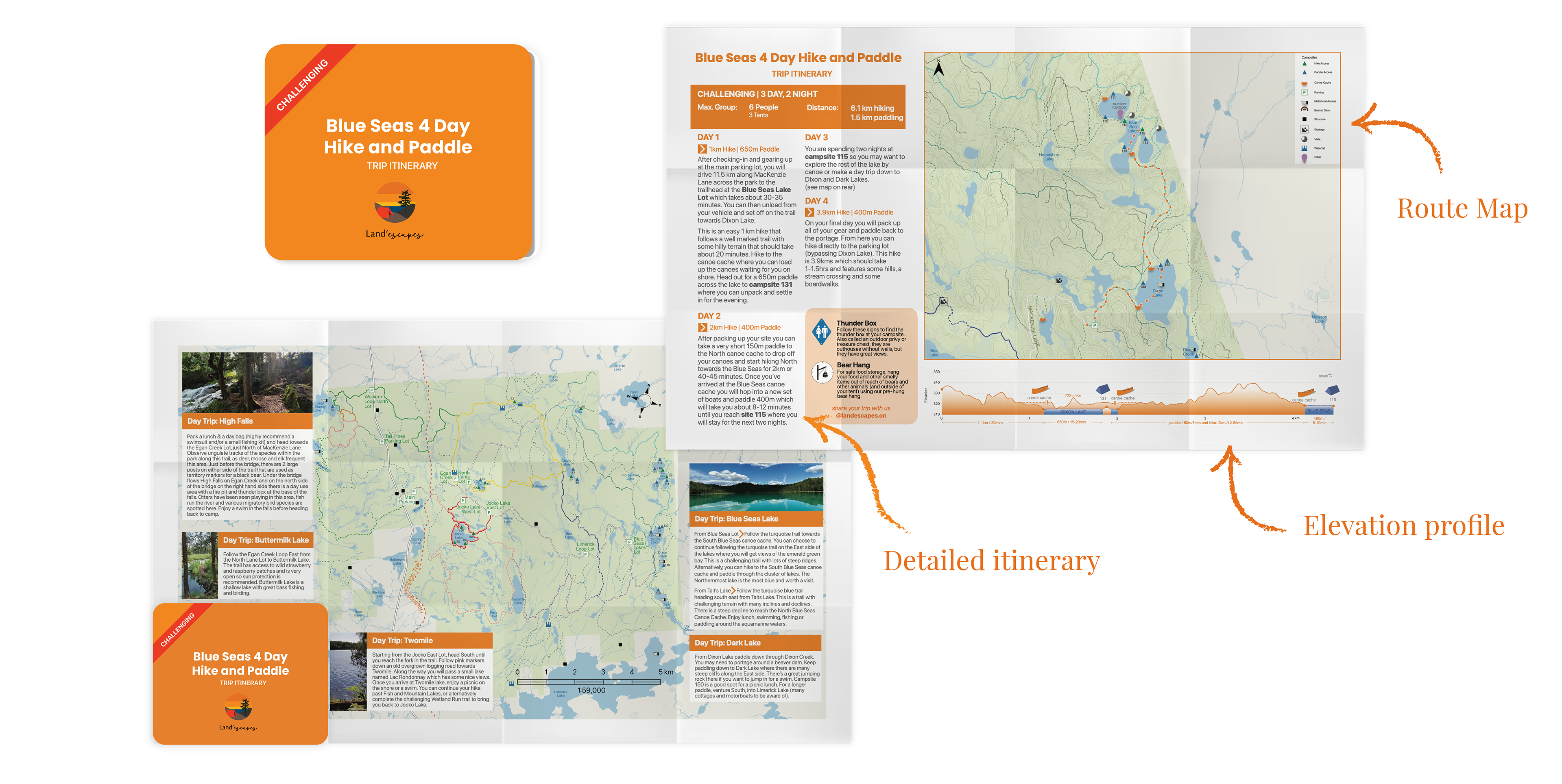
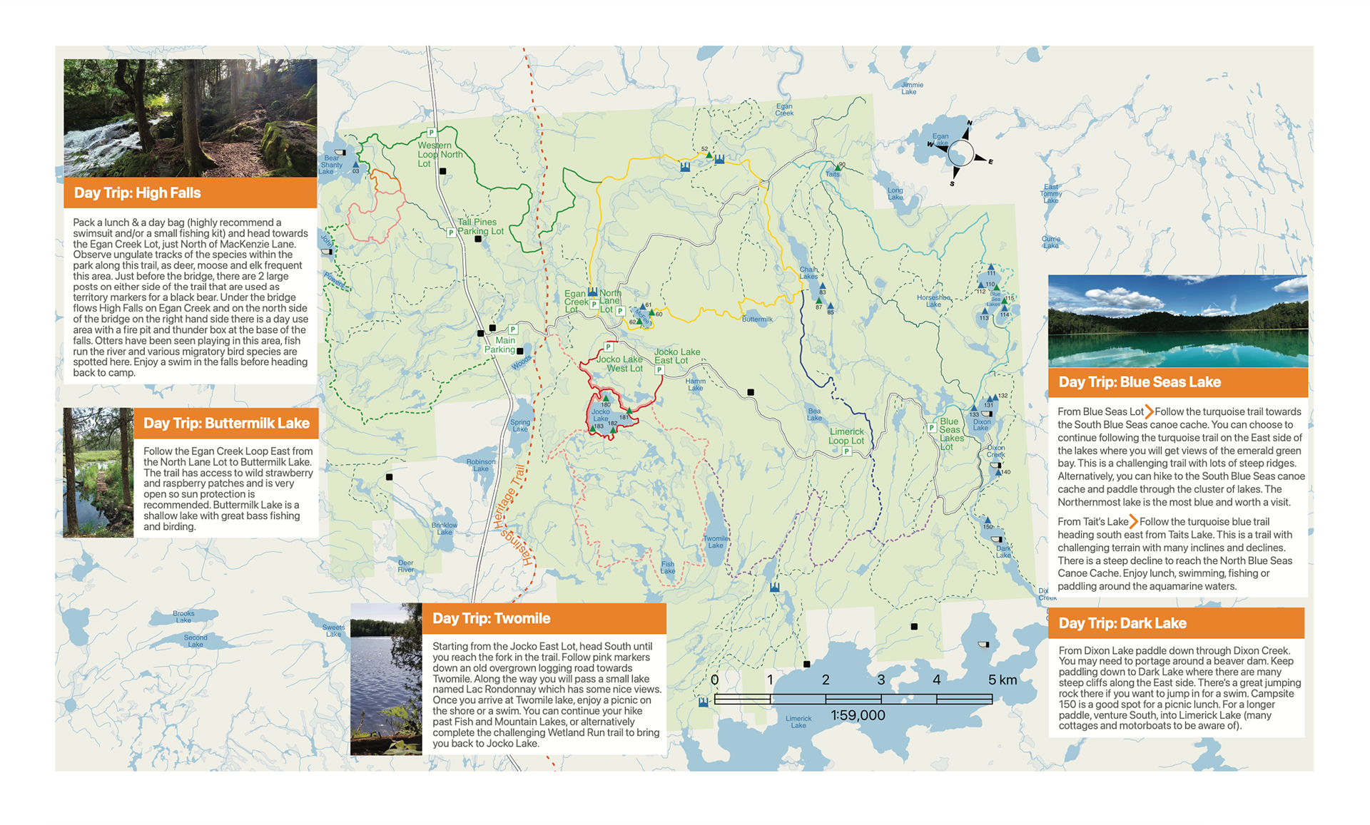
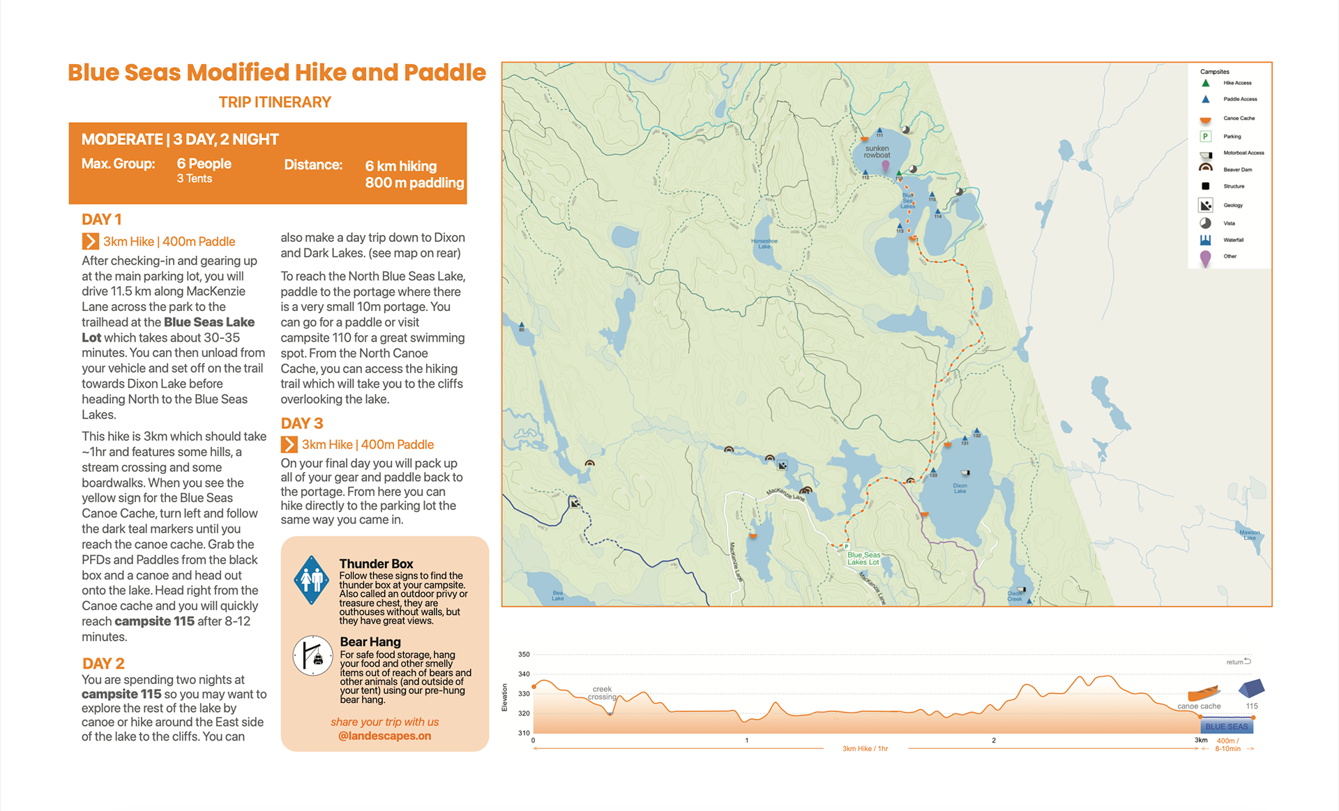
Printed Itinerary
Created a physical itinerary for visitors. The front of the itinerary included an overview map of the park with recommended day trips. The reverse side included an overview of the trip with detailed directions for each day of the trip. A customized map of the trip route as well as an elevation profile was included.
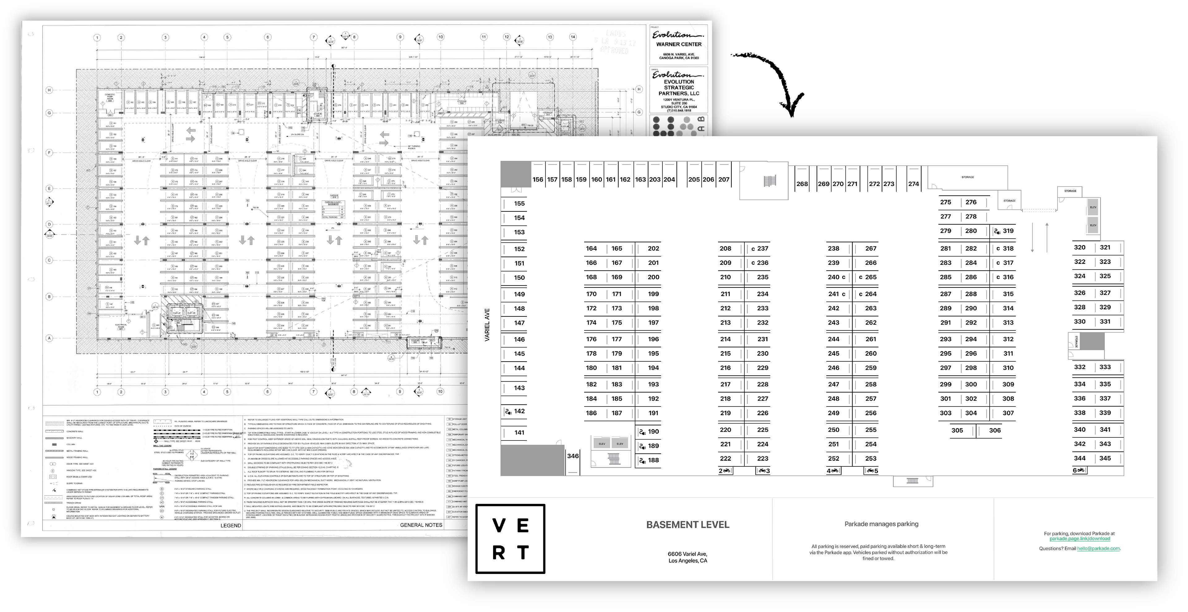
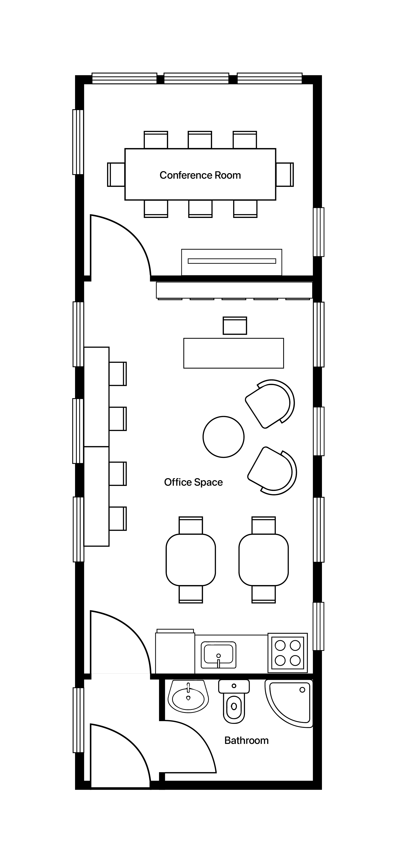
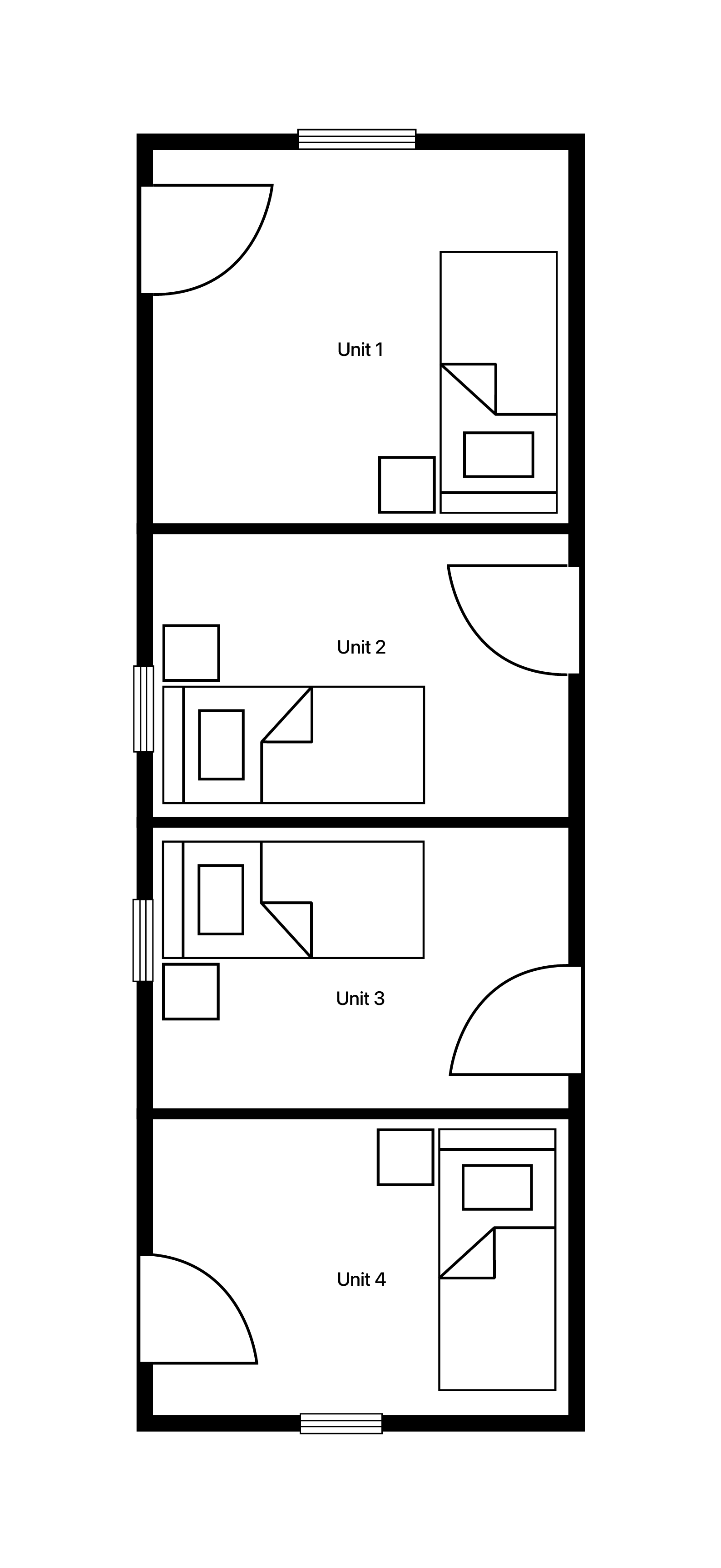
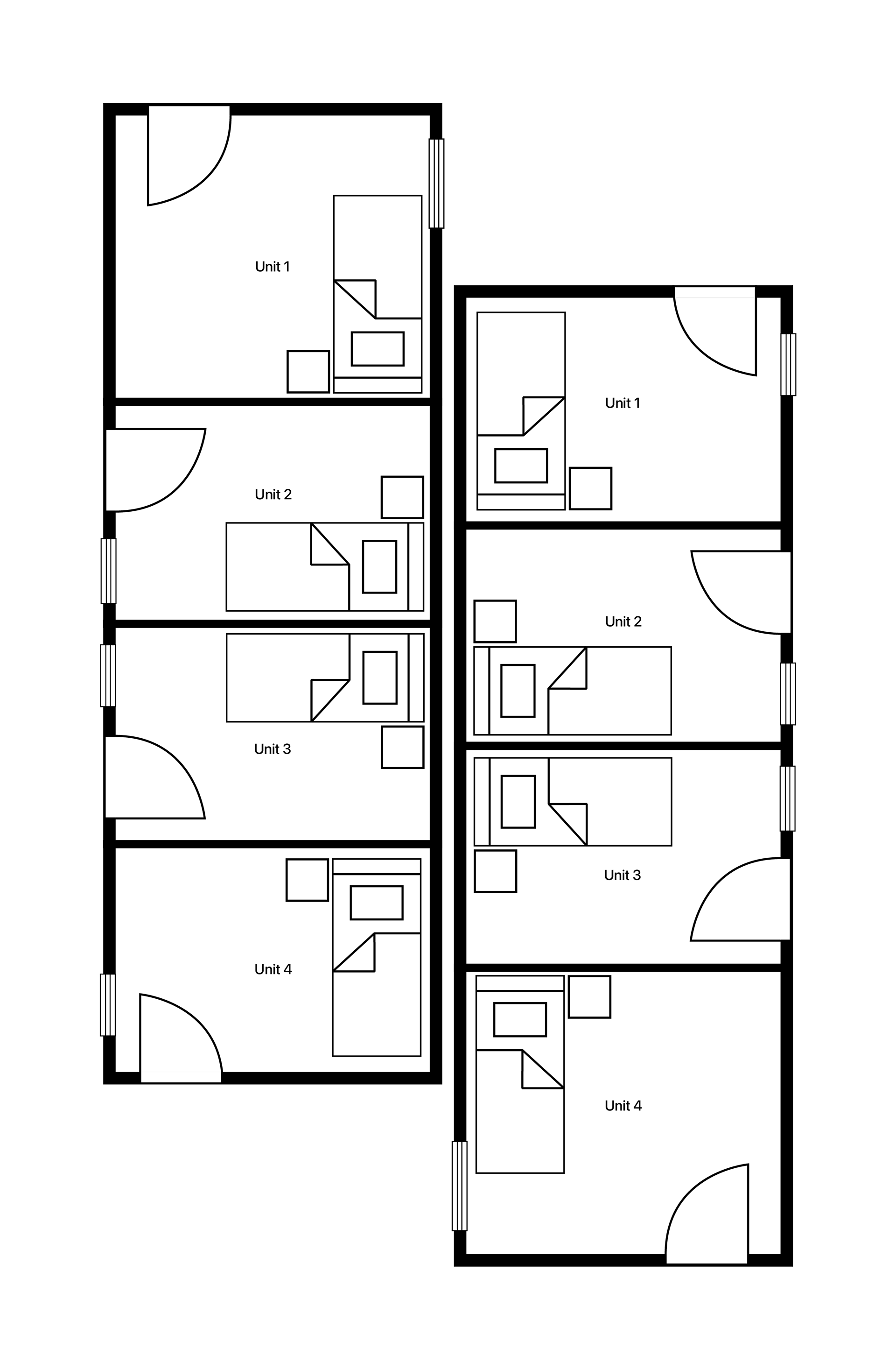
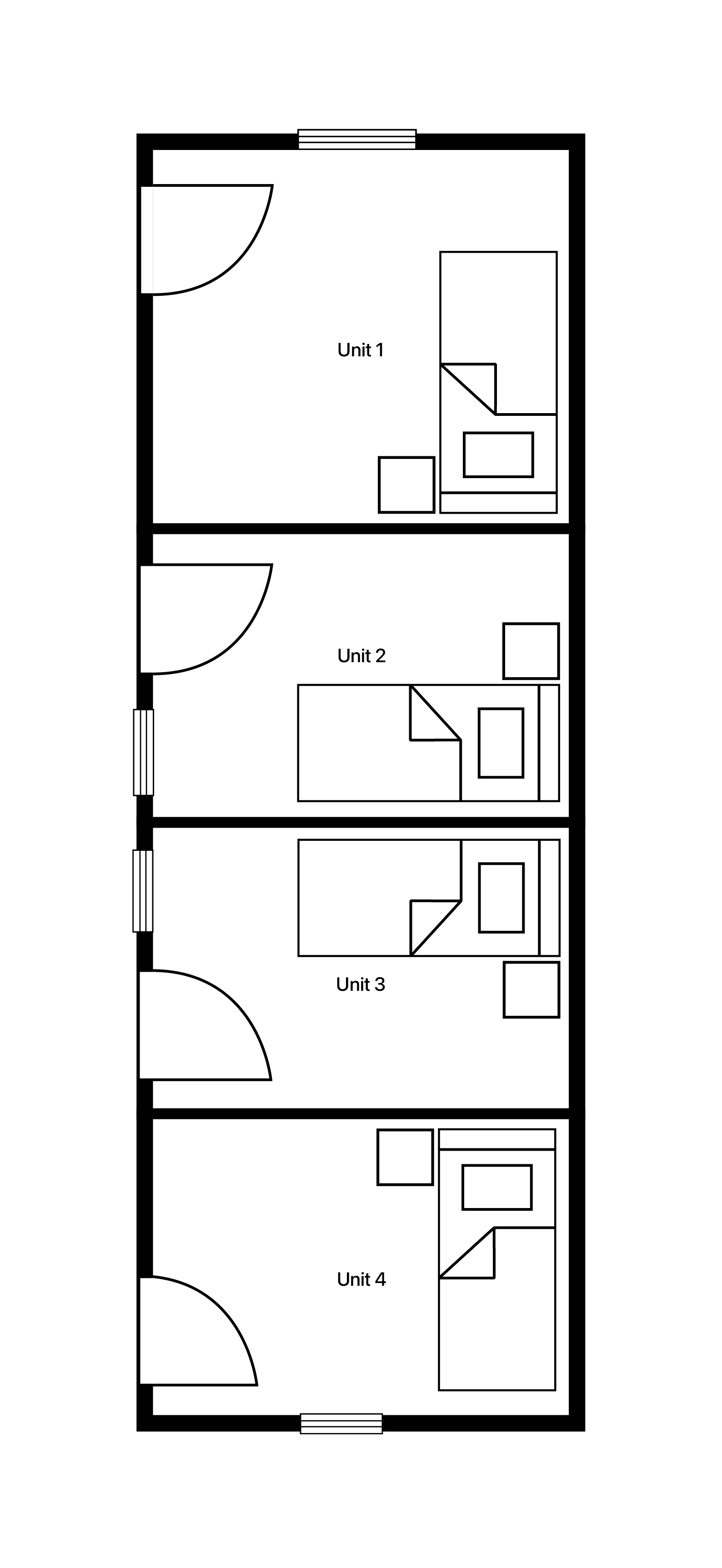
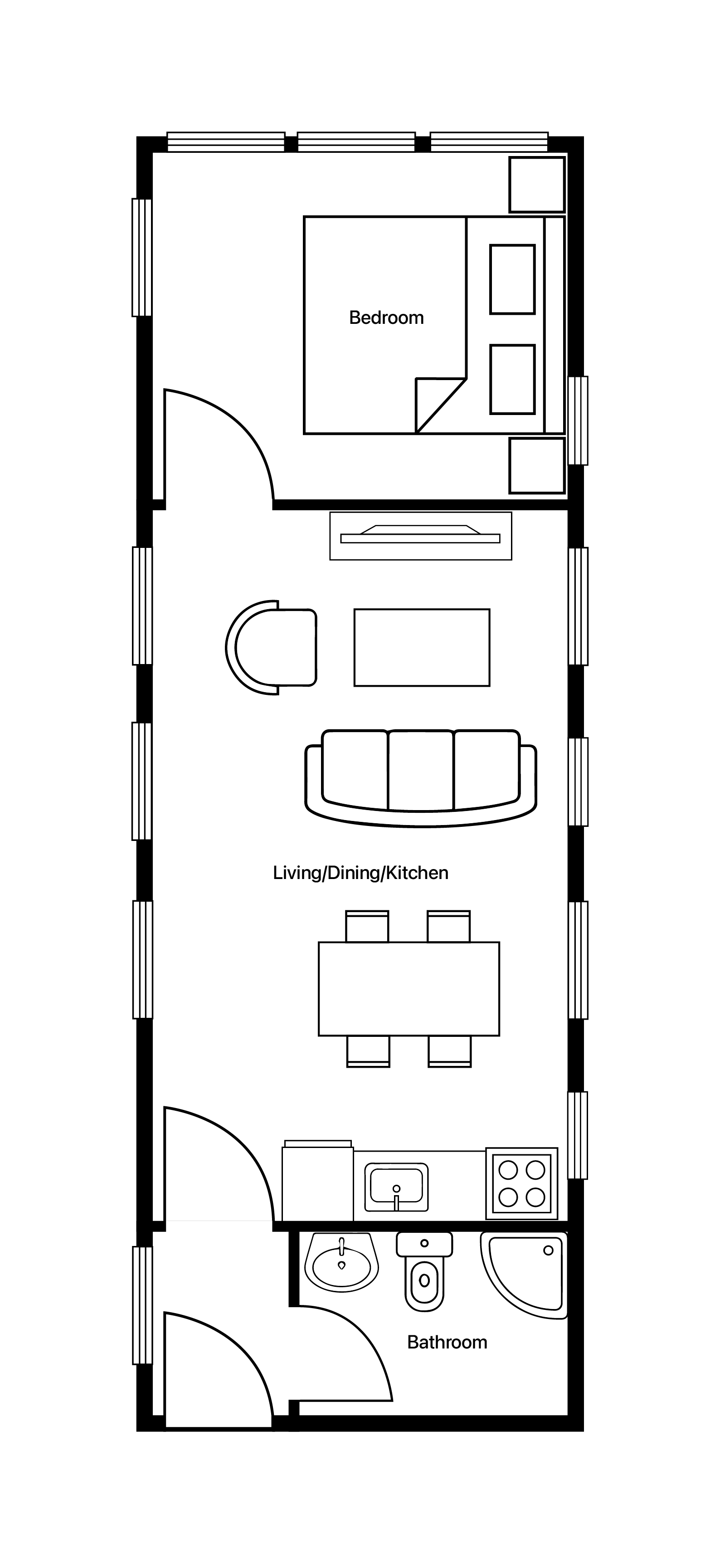
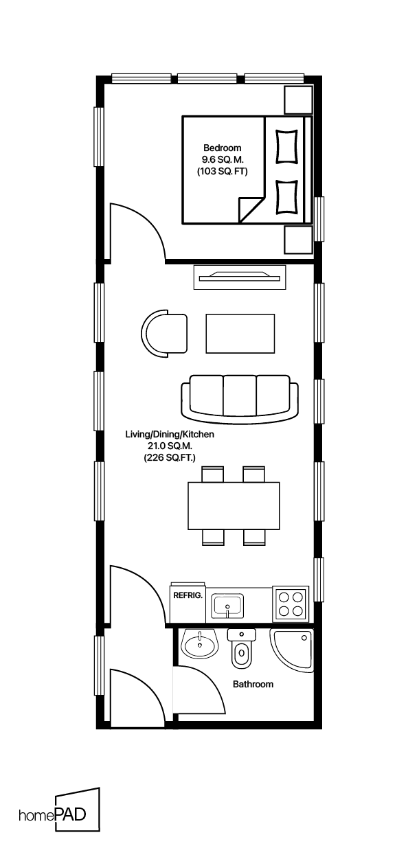
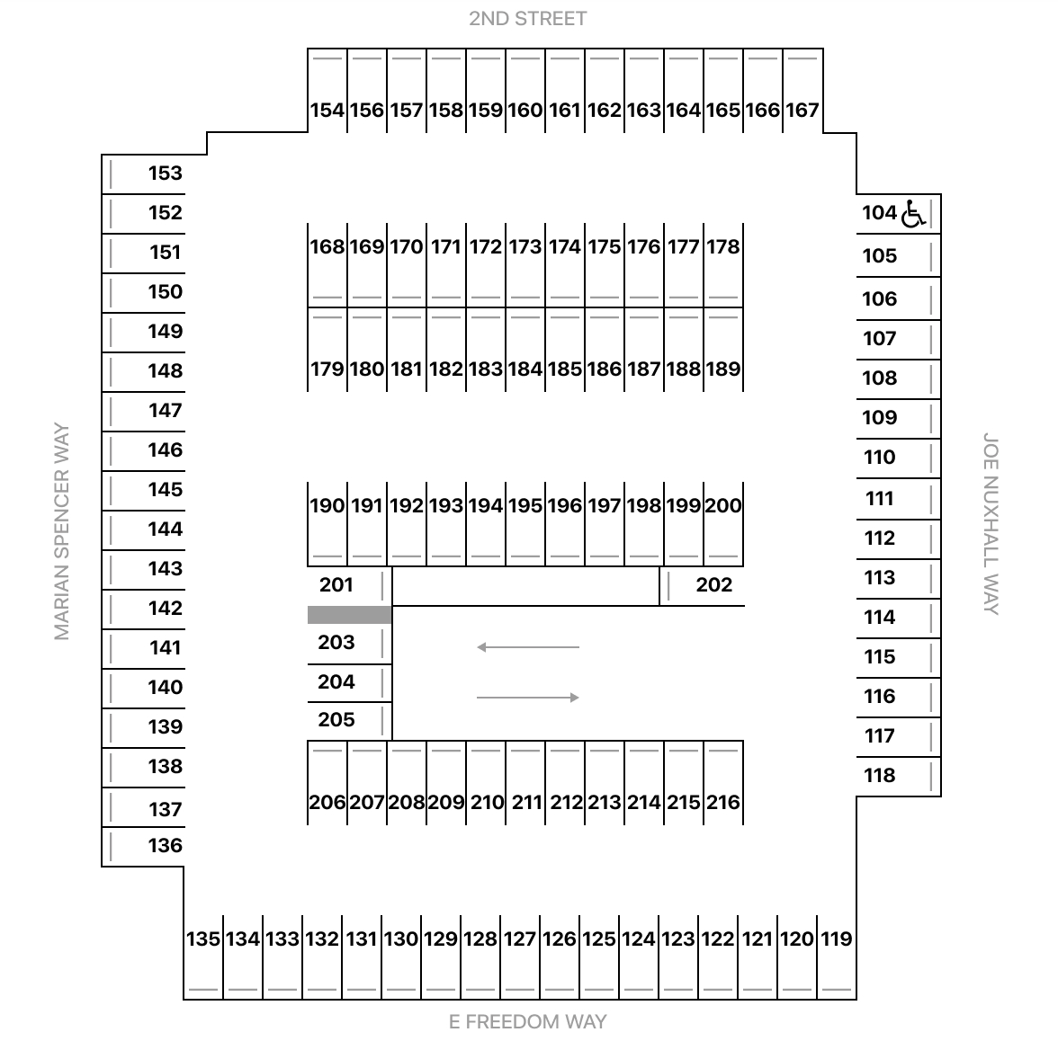
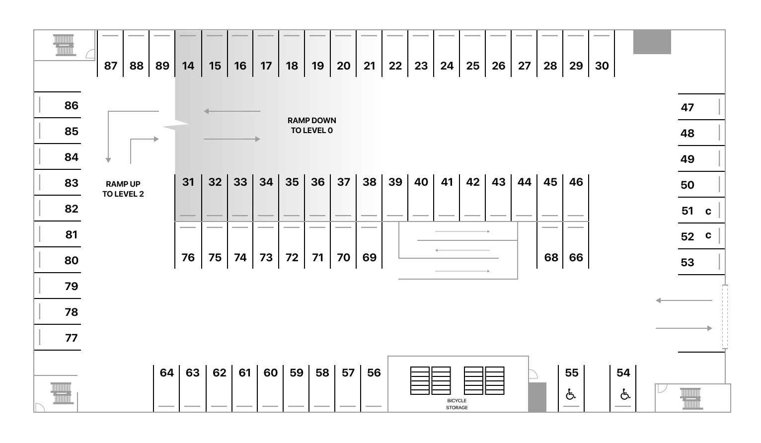
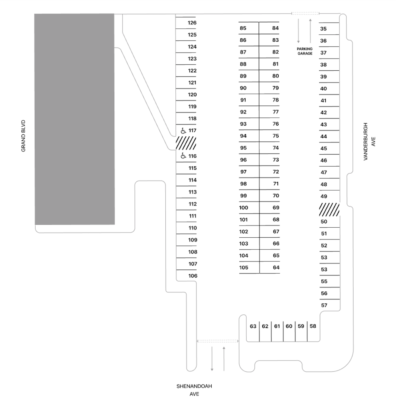
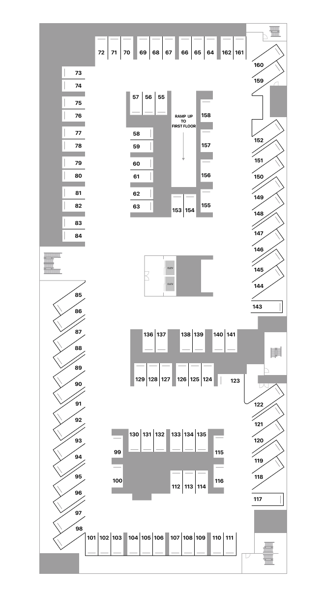
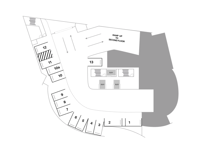
Floor Plans and Interior Layouts
Transforming blueprints, schematics, or rough sketches into refined, navigational maps.
Artistic Maps
Maps that blend geographical accuracy with a creative touch, transforming locations into captivating works of art.